
As National Hurricane Center (NHC) experts have started tracking a new disturbance in the Gulf, the National Weather Service (NWS) warned people in hurricane-prone areas that there’s still a “long season to go” when it comes to storms.
Newsweek reached out to the NHC via email for comment.
Why It Matters
The Atlantic hurricane season began on June 1 and runs through November 30. The last storm to materialize was Tropical Storm Chantal in early July, which brought flooding rainfall across parts of the East Coast. The next storm will be named Dexter.
The National Oceanic and Atmospheric Administration (NOAA) is predicting from 13 to 19 named storms for this year’s Atlantic hurricane season, with six to 10 strengthening into hurricanes and three to five into major hurricanes. Agency forecasters are 70 percent confident in the ranges, the report said.
What To Know
After a relatively active start, the Atlantic Ocean has been somewhat quiet throughout much of July. However, the NWS issued a warning on Tuesday that the hurricane season is far from over.
“On average, 86% of all named tropical systems in the Atlantic occur after August 2, and the first hurricane doesn’t form until August 11,” the NWS said in a post on X, formerly Twitter. “We have a long season to go.”
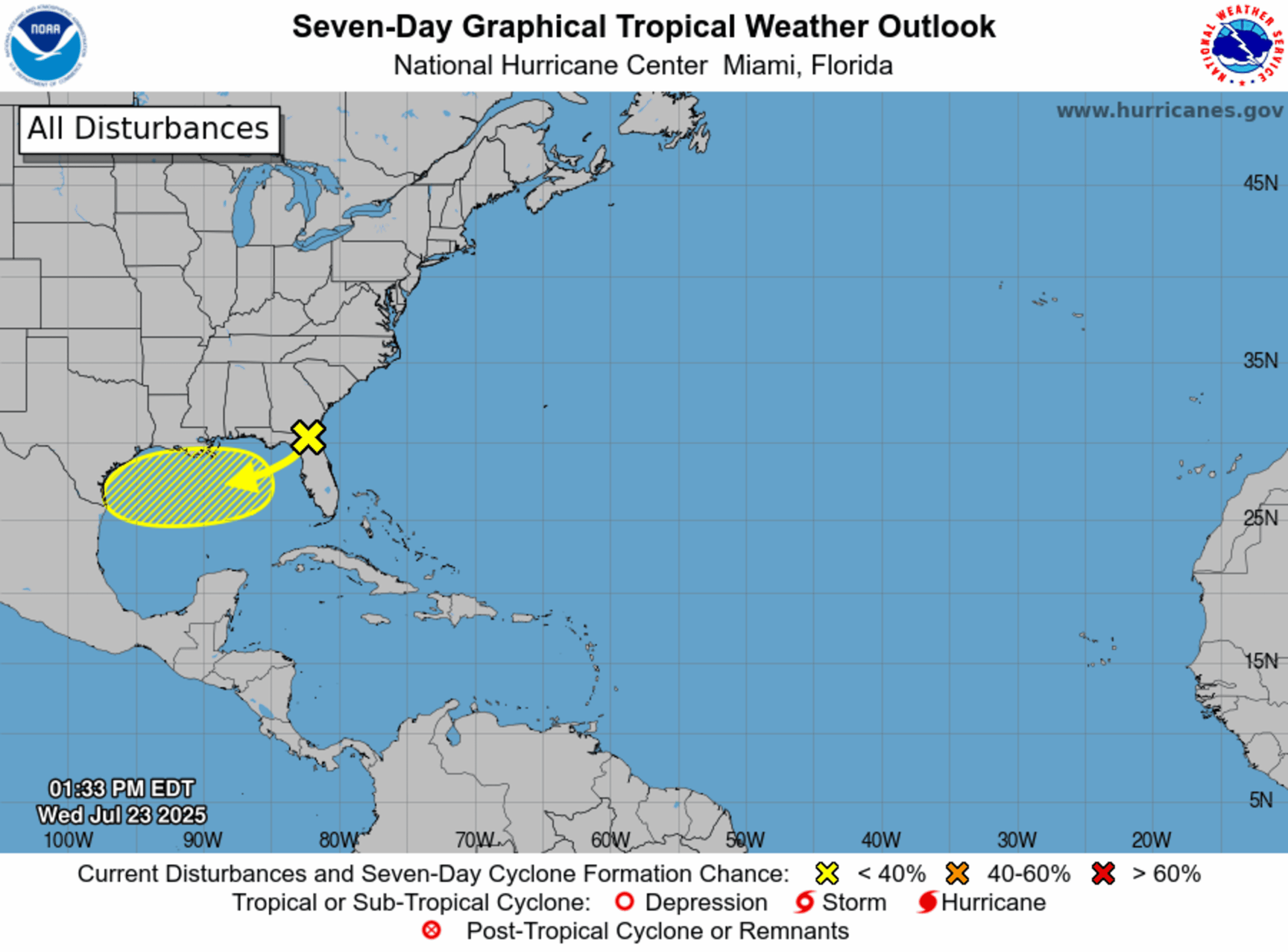
The warning comes as meteorologists with the NHC begin to track a new system that has a low chance of emerging in the Gulf within the next week.
National Hurricane Center
As of the most recent update from the NHC, the disturbance is a “trough of low pressure near northern Florida,” which is producing showers and thunderstorms in the area.
A forecast from the NWS office in Jacksonville, Florida, shows that no active weather alerts are in place, although the region was expecting some rain on Wednesday.
“Over the next day or two, this system is forecast to move west-southwestward into the north-central portion of the Gulf where some slow development is possible,” the NHC said.
Formation chances remain low, at 10 percent, for the next 48 hours as well as over the next seven days.
What People Are Saying
NHC, in a tropical weather outlook: “By this weekend, the system is likely to move inland, ending its chances for development. Regardless of tropical cyclone formation, locally heavy rainfall is possible for portions of Florida over the next day or so, and for the northern Gulf coast through this weekend.”
NWS said on a hurricane preparedness website: “While hurricanes pose the greatest threat to life and property, tropical storms and depression also can be devastating. The primary hazards from tropical cyclones (which include tropical depressions, tropical storms, and hurricanes) are storm surge flooding, inland flooding from heavy rains, destructive winds, tornadoes, and high surf and rip currents.”
What Happens Next
It remains to be seen whether the disturbance will strengthen into Tropical Storm Dexter, although chances remain low. People in hurricane-prone areas are urged to prepare before a storm takes shape.