
The threat of flooding was expected to persist for parts of the East Coast as Tropical Depression Chantal was forecast to continue its movement across the eastern U.S. on Monday.
Why It Matters
Tropical Storm Chantal was the third named storm of the Atlantic Hurricane season after storms Andrea and Barry in June. It has since been downgraded to tropical depression status.
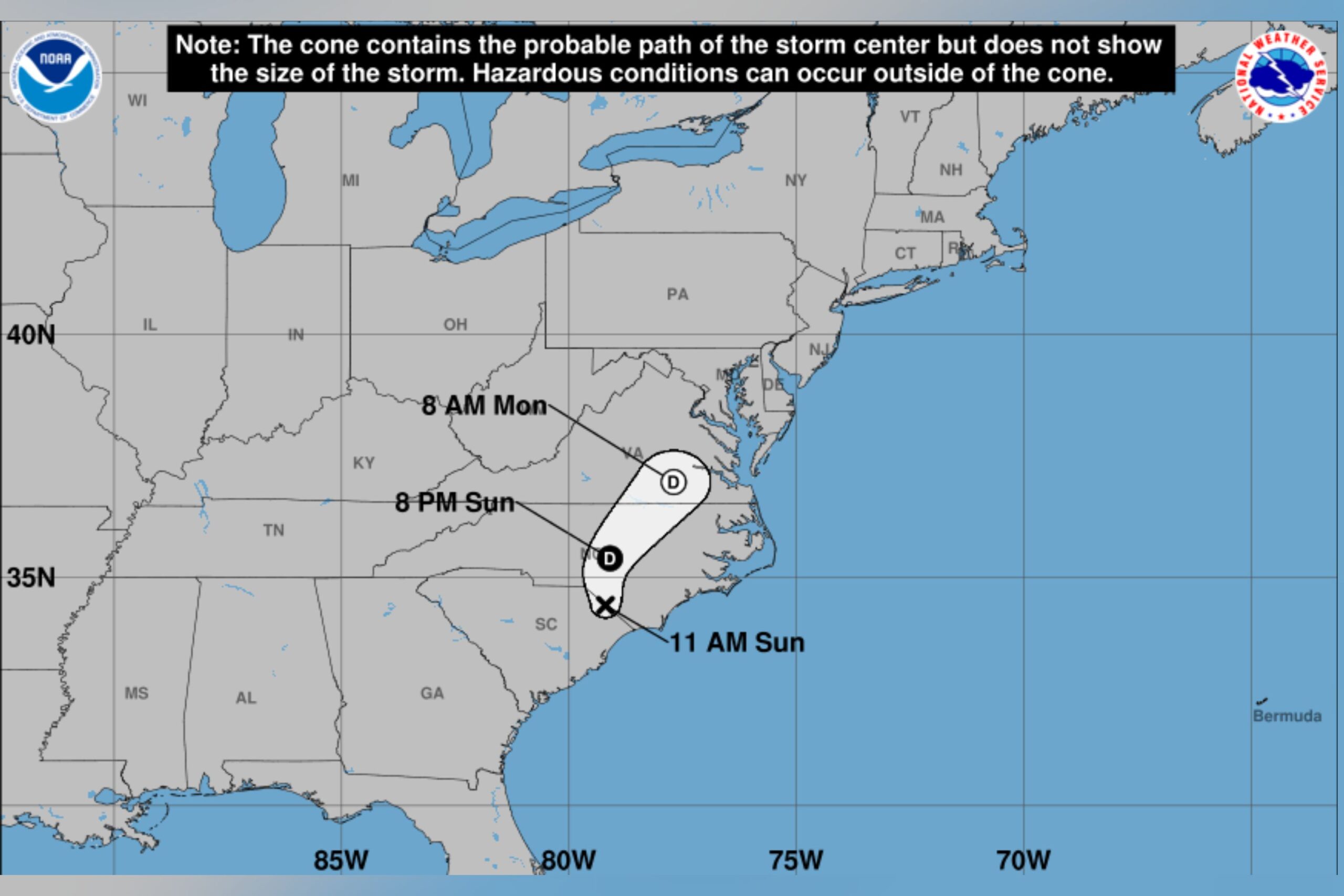
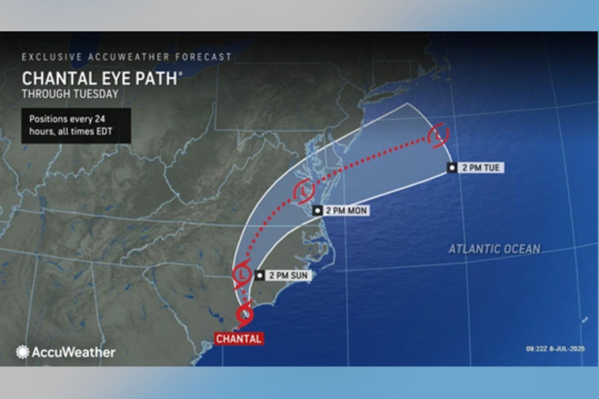
The system made landfall along the South Carolina coast early on Sunday morning, bringing strong winds and heavy rain. Flood watches were in place from the National Weather Service (NWS) for parts of Virginia, Maryland, and Delaware as of early Monday morning.
What To Know
The Weather Prediction Center (WPC) said in an update late Sunday night that the system was moving northeast around 12 miles per hour and this motion was expected to continue “with an increase in forward speed” on Monday.
Heavy rainfall and flash floods were possible in Virginia on Monday, the agency said.
National Hurricane Center
The WPC added that “life threatening” surf and rip current conditions would likely persist along the U.S. East Coast, from northeastern Florida to the mid-Atlantic, for the next day or so.
Rainfall totals of seven to eight inches have been recorded west of Durham, North Carolina, spanning the area between Goldston, Burlington, and Caldwell, according to the WPC.
Local outlets reported severe flooding in the state, with state of emergencies declared in Moore and Orange Counties.
AccuWeather
WRAL News reported that dozens were rescued in Durham County after rains caused the Eno River to overflow. Floodwaters also prompted the closure of multiple roads and highways, including parts of the I-40 and I-85 in Orange County, it said.
According to WNCN, at least two water rescues were carried out in Moore County on Sunday, with road closures due to flooding along the U.S. 1 in Aberdeen and N.C. 5.
🌧️Chantal brought a considerable amount of rainfall to a narrow swath of central NC.
🚨Rivers, creeks and streams will remain elevated, fast moving and dangerous over the next few days.
It will be warm and humid today for the recovery efforts with isolated storms this PM. #NCwx pic.twitter.com/NLDap865a4
— NWS Raleigh (@NWSRaleigh) July 7, 2025
What People Are Saying
AccuWeather lead hurricane expert Alex DaSilva said: “This was a classic example of homegrown development, by which a tropical storm formed close to the southeast Atlantic coast and in an area where it is typical for July.”
Meteorologist Will Haenni said on X, Sunday: “More flash flooding ongoing in a different part of the country tonight. A dangerous situation is playing out in central North Carolina, near Chapel Hill. Radar estimating pockets of double digit rainfall thanks to the remnants of Tropical Storm Chantal. Turn around, don’t drown!”
Meteorologist Jacob Lanier said on X, Sunday: “More major flash flooding occurring tonight, but in North Carolina. Tropical Depression #Chantal has dropped over 6″ of rain west of Raleigh-Durham with rapidly rising river levels. Several water rescues reported around Chapel Hill.”
What Happens Next
According to forecasters at AccuWeather, a continued weakening of winds into early this week will bring coastal hazards to an end.