
A newly released satellite image from NASA‘s Earth Observatory has unveiled dramatic evidence of the extreme weather phenomena that shaped the prehistoric American West.
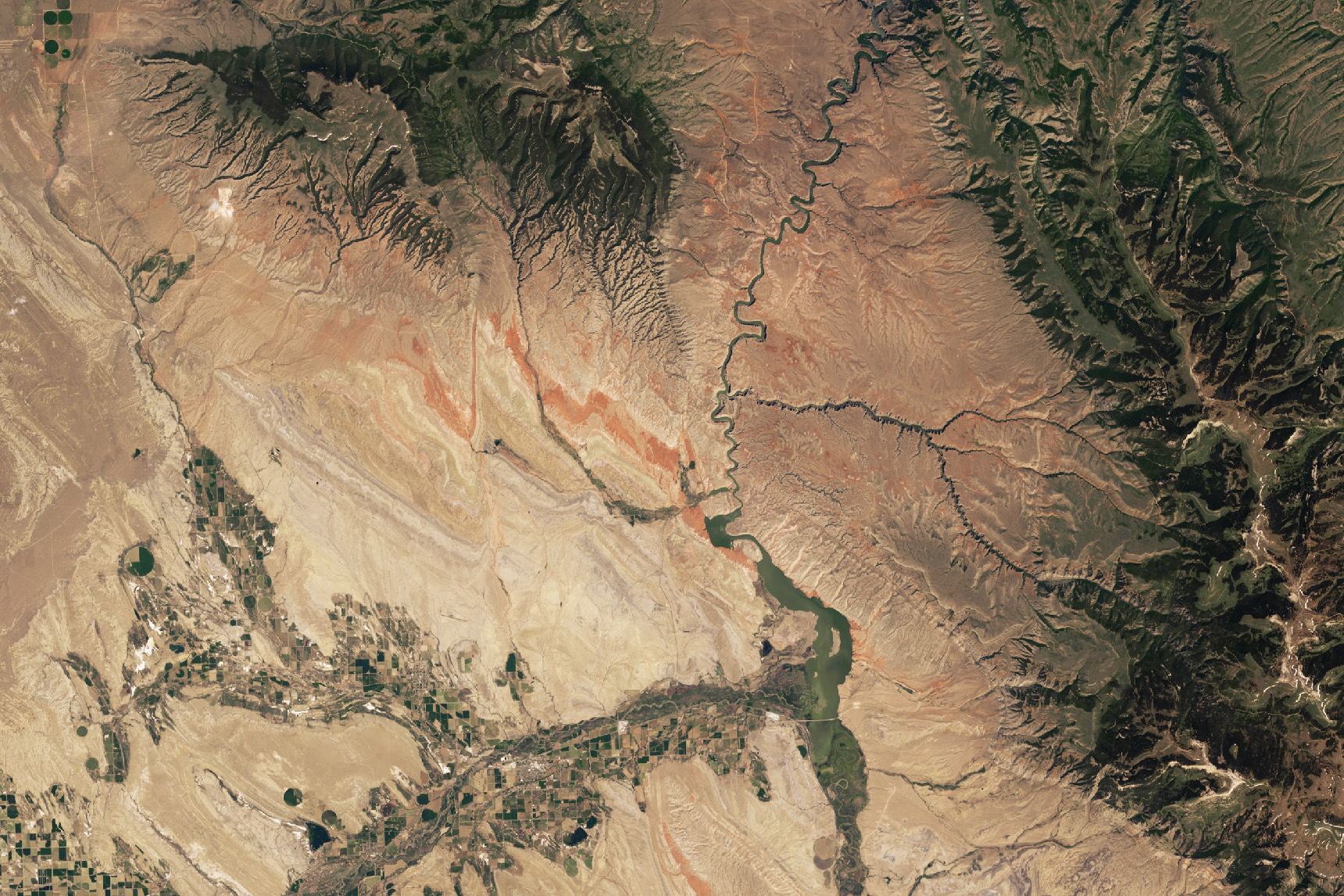
The image, captured by the Landsat 9 satellite’s Operational Land Imager-2 in June 2024, shows deep red rock formations outcropping in Montana and Wyoming that scientists believe were formed by ancient “megamonsoons” some 220 million years ago.
At the center of this discovery is the Chugwater Formation in the Bighorn Basin, an oval-shaped lowland bordered by six mountain ranges. The basin spans 150 miles across parts of Montana and Wyoming and is famed for its fossil troves.
Scientists analyzing the image said the area’s distinctive reddish hue signals vast oxidation of sedimentary layers caused by extreme climate swings during the Triassic Period, when North America was still part of the supercontinent Pangaea.
NASA Earth Observatory / Wanmei Liang
The NASA image shows prominent geological folds cutting through the landscape, a result of millions of years of tectonic activity. These formations originated when landmasses, once joined in Pangea, later broke apart and recombined to make the continents we live on today.
During that period, large-scale “megamonsoons” are believed to have swept through the tropical belts of the former supercontinent, bringing powerful seasonal wet and dry cycles. These climate shifts are thought to have triggered oxidation—rusting—of exposed sediments across enormous areas.
The red rocks captured in the Landsat image are composed of hematite (iron oxide)-rich layers known as “red beds” that developed under these ancient atmospheric conditions. Scientists have identified similar rust-colored strata on several continents.
One of the clearest expressions of this process lies in the Bighorn Basin, particularly at its northern end where the Chugwater Formation emerges.
This distinct band of red intersects Bighorn Canyon, a deep rift in the Earth that extends north into Montana. The canyon reaches up to 2,500 feet deep and is a central feature of the Bighorn Canyon National Recreation Area.
The park, established in 1966 following the construction of Yellowtail Dam, encompasses more than 70 miles of lake along the Bighorn River and offers a window into both geological and human history.
Within the canyon and its surrounding wilderness, researchers have uncovered fossils dating to the Jurassic Period. The diverse ecosystem now hosts bighorn sheep, wild horses and coyotes across its shrubland and woodland expanses.
Meanwhile, artifacts preserved along the Bad Pass Trail mark a route once used by indigenous communities over thousands of years.
Today, the recreation area attracts over 200,000 visitors annually for hiking, fishing, boating and exploration of the landscape’s ancient past.
Do you have a tip on a science story that Newsweek should be covering? Do you have a question about stars? Let us know via science@newsweek.com.