
Most California reservoirs continue to perform above their historical average for this time of year, but concern is rising as the state’s Sierra Nevada snowpack continues to lag.
Why It Matters
The Sierra Nevada snowpack provides around 30 percent of California’s water needs. In the spring, the snow melts and supplements local rivers and reservoirs to carry them through the dry summer months.
For the past two years, the snowpack has been above average, which has helped relieve a yearslong drought that has plagued the Golden State. Much of the winter snow in 2023 and 2024 came from atmospheric rivers that brought heavy precipitation to mountainous regions. But this winter hasn’t been as prolific when it comes to snow-producing storms, sparking concerns that another dry summer might stress the state’s water supply.
What to Know
As of February 24, California’s Sierra Nevada snowpack is 88 percent of average for this time of year, and only 73 percent of average for the April 1 amount, which is the final measurement of the season.
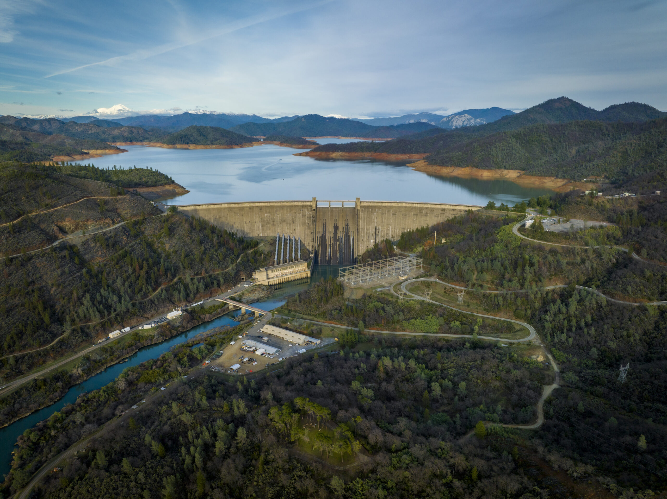
Brandon Buza/Getty
An abnormally dry January significantly slowed California’s rising snowpack levels, and although several winter storms brought more snow to the state through the first half of February, they couldn’t fully recover.
Meanwhile, California Department of Water Resources (DWR) data shows most of the state’s major reservoirs are performing much above average for this time of year. For example, although Lake Oroville and Lake Shasta, the state’s two largest reservoirs, are only at 84 percent and 77 percent capacity, respectively, the water levels are 131 percent and 109 percent of what is typically seen at this time of year.
If snowpack fails to recover throughout March, a valid fear given dry forecasts in the state’s future, according to the DWR, it’s unlikely the reservoirs will suffer immediately. Instead, in the spring when water levels begin rising quickly as snow melts, reservoirs across the state might not see as much of an influx as usual. Once the dry season hits in the late spring and summer, those reservoirs could fall to concerning levels.
However, there’s still a chance the state’s snowpack will recover, with a little over a month to go before the final measurement of the season on April 1. A DWR spokesperson told Newsweek that in 2006, snowpack measured on March 1 was the lowest documented while still having an average or above-average snowpack year by April 1. The snowpack was only 73 percent of average on March 1, but had jumped to 125 percent by April 1, the spokesperson said.
What People Are Saying
The DWR spokesperson told Newsweek: “The April 1 snowpack is an important benchmark for water managers who rely on snowpack and snowmelt runoff forecast data to plan for the amount of water that will flow into California’s rivers and reservoirs in the spring. The State Water Project and water districts use this data to plan for how much water will be available for urban and agricultural water users during the drier summer and fall months.”
What Happens Next
The DWR expressed concerns about another possible dry spell throughout March, further inhibiting the state’s snowpack, but the National Weather Service (NWS) Climate Prediction Center anticipates that northern California will experience below-average temperatures and above-average precipitation over the next eight to 14 days, which could result in snowfall.
However, forecasts are apt to change, and only time will tell how the state’s snowpack performs this year.