
Tropical Storm Juliette has formed in the Pacific Ocean, becoming the 10th tropical storm of the 2025 East Pacific hurricane season, the National Hurricane Center (NHC) said on Monday.
Why It Matters
No coastal watches or warnings were immediately in effect, the NHC said. It arrives after Hurricane Erin triggered warnings along the U.S. East Coast last week.
What To Know
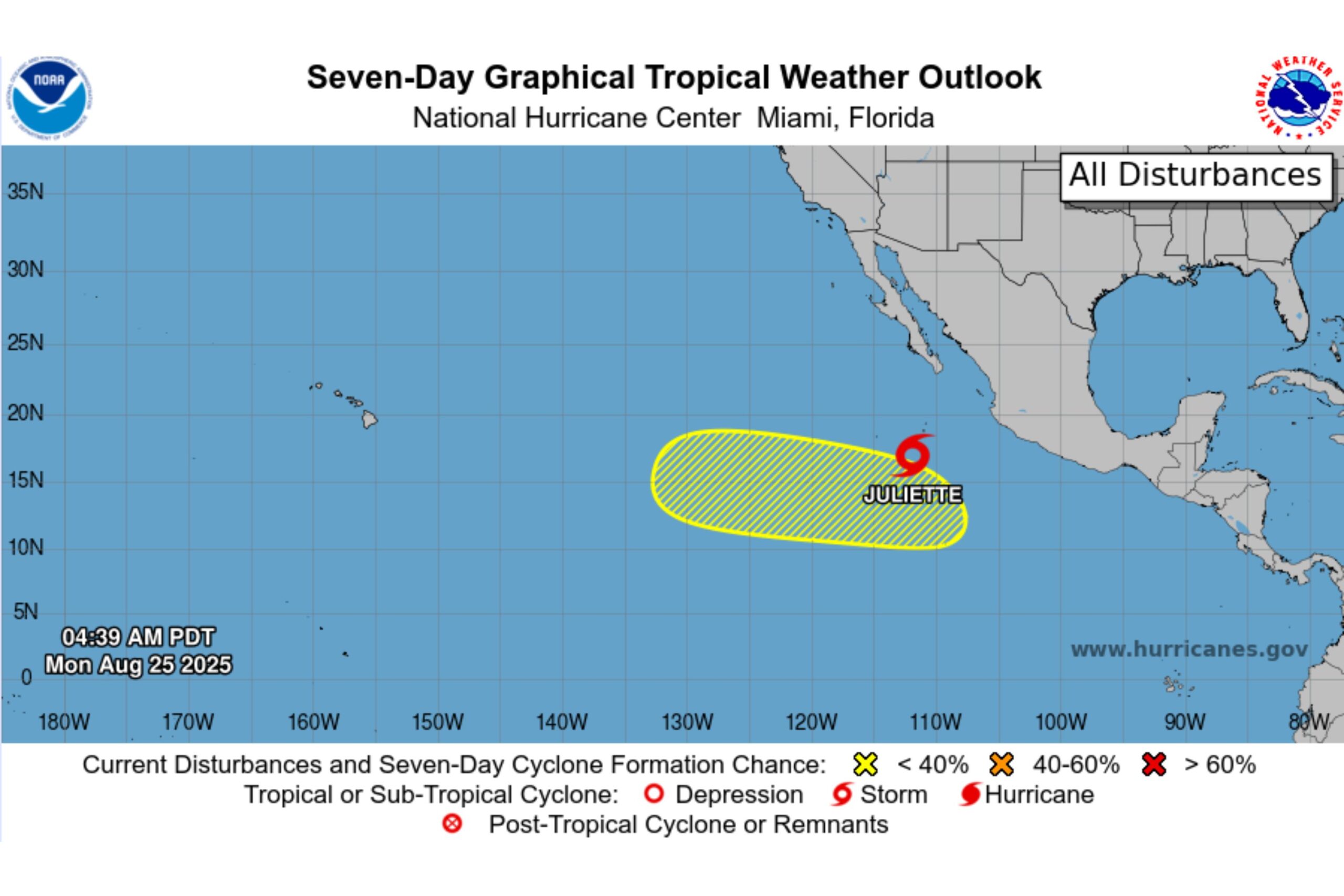
In a Monday morning update, the NHC said Juliette was located hundreds of miles south-southwest of Baja California’s southern tip.
Maximum sustained winds near 40 miles per hour with higher gusts were reported, with tropical-storm-force winds extending up to 60 miles from the system’s center.
“Juliette is moving toward the west-northwest near 13 mph (20 km/h) and this motion is expected to continue during the next day or two, followed by a motion to the northwest,” it said.
“Some strengthening is forecast through Tuesday,” it added. “Weakening should begin on Wednesday.”
The system would remain out over the open Pacific, the agency wrote on X.
Meteorologists at the NHC were also monitoring a disturbance nearby which was given a 20 percent chance of cyclone formation through seven days.
“An area of low pressure is likely to form in a few days well to the south of the southern tip of the Baja California peninsula. Subsequent slow development is possible late this week into the weekend as the system moves westward to west-northwestward at 10 to 15 mph,” it said.
Meanwhile, the NHC continues to track Tropical Storm Fernand, which was expected to remain out over the open Atlantic. The tropical storm was moving north-northeast at around 12 miles per hour, the NHC said.
“On the forecast track, Fernand should move across the open waters of the subtropical central Atlantic well east and northeast of Bermuda,” said the agency.
National Hurricane Center
What People Are Saying
The National Hurricane Center wrote in a post on X on Sunday: “Tropical Depression Ten-E is expected to strengthen to a tropical storm on Monday but will remain out to sea over the Pacific.”
Meteorologist James Spann wrote on X on Sunday: “Tropical Storm Fernand, in the open Atlantic with winds of 45 mph, is about 295 miles east of Bermuda. It is moving to the north/northeast at 13 mph, and will stay far from land. It becomes post-tropical Tuesday night.”
Meteorologist Levi Cowan wrote on X on Saturday: “Tropical Storm Fernand has formed (formerly Invest 90L) in the western Atlantic. Fernand will track north-northeastward to the east of Bermuda with modest strengthening expected, limited by some vertical shear. No impacts to Bermuda or Atlantic Canada are expected.”
What Happens Next?
Regular forecast updates are issued by the NHC on its website and social media channels.