
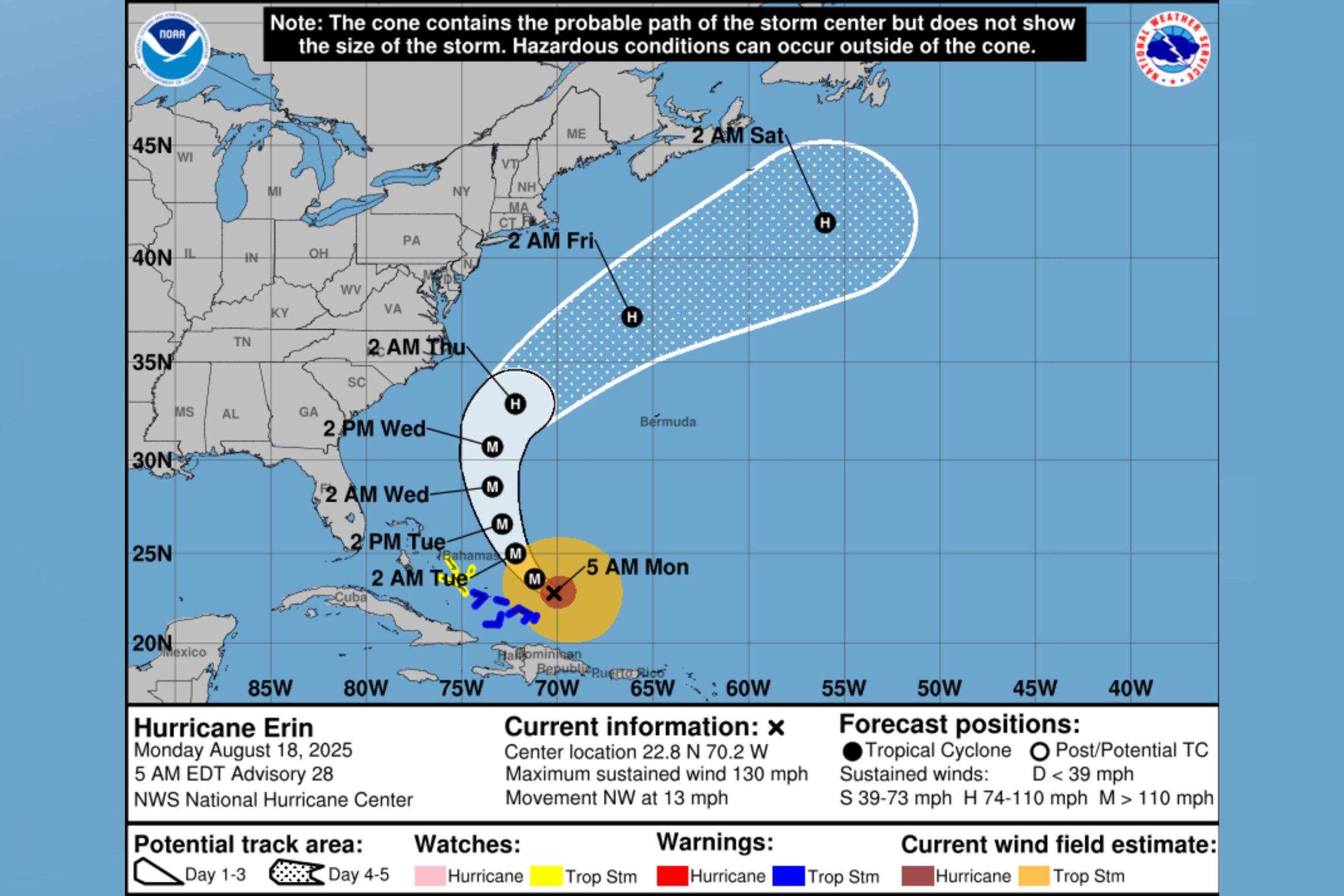
Hurricane Erin was expected to move between the U.S. East Coast and Bermuda this week, after the system returned to Category 4 strength on Sunday.
Why It Matters
Erin is the fifth named storm of the 2025 Atlantic hurricane season and the first hurricane, as well as the first major hurricane.
The NHC has warned that the system, a Category 4 hurricane at the time of writing, could bring “life-threatening” surf and rip currents across the U.S.’ Eastern Seaboard this week.
What To Know
On Monday morning, the NHC said Erin was located just east of the southeast Bahamas, and was moving toward the northwest near 13 miles per hour, with a “gradual” turn north expected later in the day.
“On the forecast track, the core of Erin is expected to pass to the east of the southeastern Bahamas today and move between Bermuda and the east coast of the United States by the middle of the week,” the agency said.
National Hurricane Center
On Sunday, the NHC downgraded Erin to a Category 3 hurricane early in the day, Reuters reported, noting that the storm had previously been recorded as Category 5, then Category 4.
Late Sunday, the NHC announced that Erin had reintensified into a Category 4 hurricane after completing an eyewall replacement cycle.
In an AccuWeather report, meteorologist Brandon Buckingham explained this meant “that as the old eyewall expands outward, a new eyewall forms closer to the center.
“Top winds often ease back during this cycle, but it is followed by another surge in wind intensity as the new eye completes organization.”
The NHC said hurricane-force winds extended outward up to 80 miles from the system’s center. Maximum sustained winds were near 130 miles per hour, the agency added.
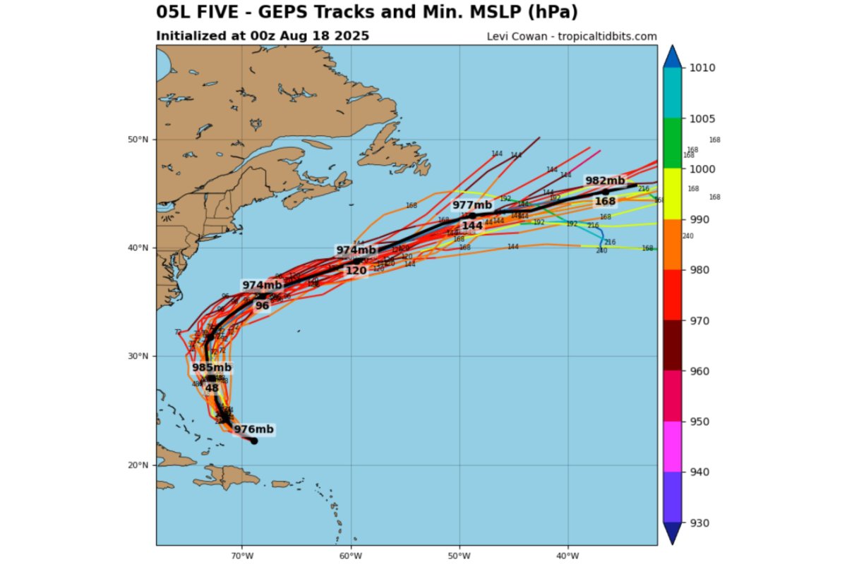
Tropical Tidbits
What People Are Saying
Meteorologist Jim Cantore said in a post on X, Monday: “Tropical Atlantic remains interesting this morning as the east coast is on alert for intense coastal and marine impacts from hurricane #Erin which appears to be ramping up again. It also continues left of track which only brings its coastal impacts closer to the eastern USA beaches. The OBX will see the worst of this likely Wednesday with 15-20′ breaking waves along SE and ESE facing beaches and considerable overwash that will cut highway 12 off from in favored overwash areas from Pea Island south.”
What Happens Next
According to the NHC, Erin is expected to see some additional strengthening on Monday.
“Even though some weakening is forecast beginning tonight, Erin will remain a large and dangerous major hurricane through the middle of this week,” it added.