
As a tropical wave gradually develops in the central tropical Atlantic this week, spaghetti models are showing a glimpse into which path a tropical storm could take should it evolve in the coming days.
Why It Matters
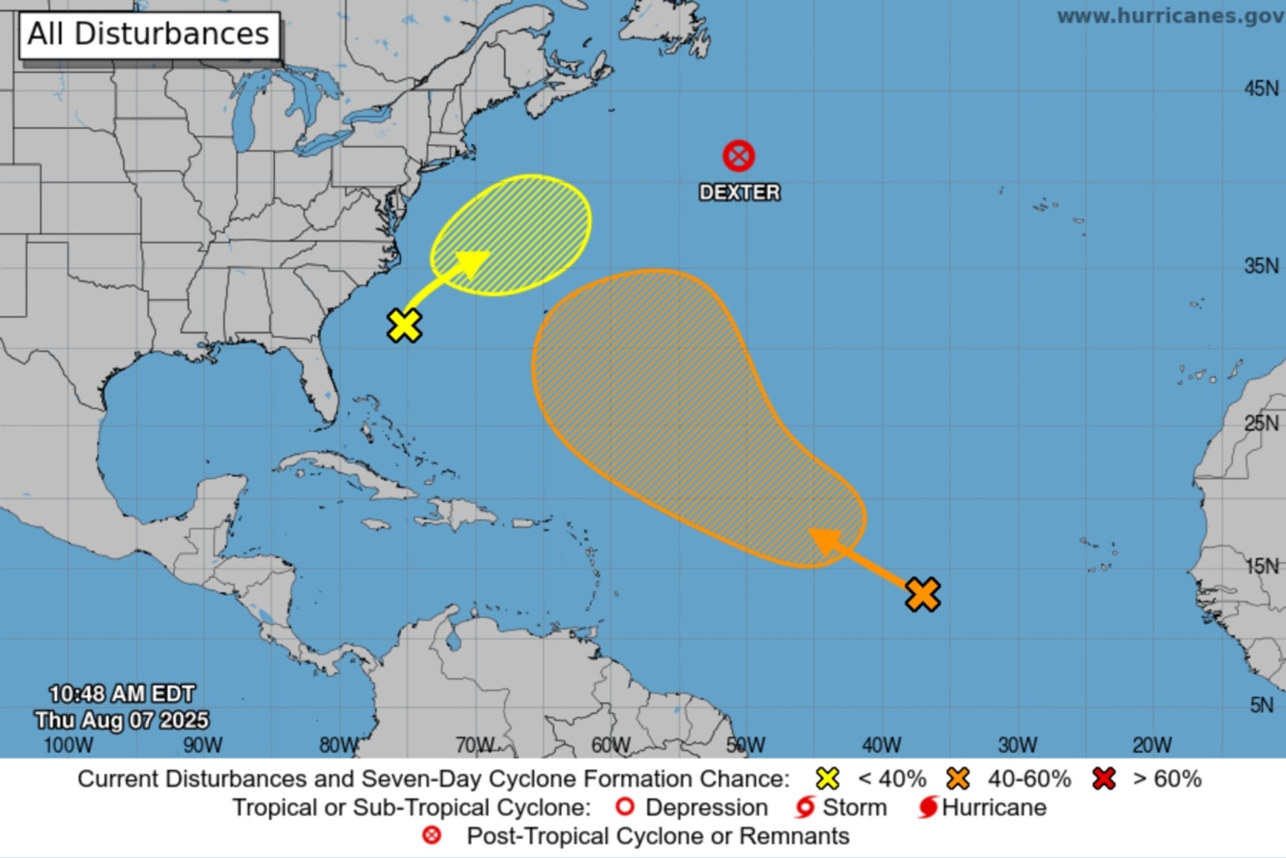
The spaghetti models, or computer models that illustrate potential storm paths, come as the Atlantic Ocean heats up as hurricane season gets underway. There have been four named storms so far this season, the most recent of which was Tropical Storm Dexter that formed over the weekend and remained out at sea.
Now, meteorologists are monitoring several other disturbances, including the tropical wave, that could become the fifth named system of the season.
What to Know
Most spaghetti models shared on the Cyclocane website show the tropical wave continuing a northwestward trek toward the U.S. before taking a slight northward turn, taking it away from the East Coast.
National Hurricane Center
Earlier this month, one model showed the possibility of a major hurricane hitting Florida, but as the tropical wave progresses, AccuWeather Lead Hurricane Expert Alex DaSilva told Newsweek updated models show the system turning away from the U.S. east of Bermuda.
Although spaghetti models are available on Cyclocane, a website that tracks tropical systems, National Hurricane Center (NHC) meteorologists have yet to produce a path graphic for the potential storm and likely won’t do so unless it strengthens. Instead, a map of the general direction of the tropical wave is available on the NHC website.
The NHC outlook for the tropical wave said it is currently “producing disorganized shower activity,” and added that there’s a moderate chance of the system strengthening into Tropical Storm Erin within the next week. Meanwhile, AccuWeather meteorologists list the storm’s strengthening chances as “high,” and expect it to do so between August 8 and 11.
Even if the storm turns away from the U.S., it could still cause some indirect impacts, such as dangerous surf and life-threatening rip tides, along the East Coast.
Weather experts have issued repeated warnings this summer that peak Atlantic hurricane season doesn’t typically hit until September, urging people to take precautionary action, such as stocking up on emergency supplies and ensuring they have proper insurance in place, before a storm forms.
The National Oceanic and Atmospheric Administration (NOAA) is predicting from 13 to 19 named storms for this year’s Atlantic hurricane season, with six to 10 strengthening into hurricanes and three to five into major hurricanes.
What People Are Saying
An AccuWeather forecast about the tropical wave: “No direct impacts are expected to land at this time, but any development could bring rough surf and rip currents to portions of the eastern Caribbean. Rip currents can also occur along the East Coast of the U.S. during the middle of next week if this area strengthens.”
NHC in an outlook for the tropical wave: “Environmental conditions are forecast to become more conducive for gradual development in a few days, and a tropical depression could form late this weekend or early next week while the system moves west-northwestward to northwestward across the central tropical and subtropical Atlantic.”
What Happens Next
Meteorologists will continue to monitor the tropical wave as it gradually develops. As of Thursday morning, no tropical storm watches or warnings have been issued for the East Coast.